Showing posts with label trekking. Show all posts

Thursday, December 23, 2021

Merry Xmas, and another photo report!

Nepal Trek, Part II: Namche to Khunde

In our last, we had arrived in Namche (often called Namche Bazaar, but the locals have moved away from that name) and found our sunset blocked by the fog. Fortunately, when my son and I dragged ourselves out of bed at 5:30 to check the sunrise, we were better rewarded.

Kongde Ri from the Everest viewpoint

The viewpoint above Namche is also the Tenzing Norgay memorial. His statue shows him holding up his ice axe with the flag attached. The summit of Everest is just visible over the ridge of Nuptse and Lhotse.

Returning to the hotel, with Kongde out in full glory.

The Moonlight Lodge, Namche. Being only a long day's walk from the airport (11 miles, which we did in 2 days), it was nicer and better supplied than most of the lodges we stayed at.

With schools centralized in the larger towns, many of the children have to board during the school term. The Namche boarding house was right below our hotel, and as we prepared to leave the children were getting ready for school.

They wore smart uniforms, and housemothers are helping braid the hair of the younger girls.

All students are taught English from a young age, it being the lingua franca  of Nepal, as it were. We met several fairly young children who spoke English very well. The Namche school, and several others in the Khumbu (the Everest region), was founded by Sir Edmond Hillary.
Students clearly had numbers (as did we, come to think of it. I was #4, my son #5, and our bags and meals were handled by number). I counted about 70 toothbrushes on the rack, making it clear why numbers were important.

Leaving town, we headed pretty much straight on up the ridge, passing a chorten (a sort of a shrine) on the ridge.

Nearly to the top, we stopped to learn more about Sagharmatha Next, which is working to create more sustainable tourism in the Khumbu. The buildings being  constructed on the hill above Namche will house art studios and artists, local and international, who will work to create art from the waste stream. In addition, the organization is working with the Park on a waste management plan, and will be rolling out "Carry Me Back," a new initiative to enlist trekkers and guides to help carry the waste back to Lukla for removal.

Project director Tom Gustafsson shows our leader, Kim Bannister, one of the paving stones supporters can soon sponsor to help with the construction. Waste bags (for the carry-out program) will also be for "sale", though at this point that aspect of the web site isn't up and running.

A short way farther up, and we were atop the ridge with view of Everest (the left-most peak), and Yaks to be dodged. They are adorable, but can be cranky, and those horns are nasty!

Approaching Khunde

However fierce yaks may be, a joyous sight for us was seeing our yaks arrive with our luggage.
Yaks arrive at the Khunde Guest House
Our room. We provided the 0-degree sleeping bags that made these rooms habitable.

The view from the room was pretty okay, and I could check on the sunrise without getting out of my sleeping bag--always nice when the overnight temps in the room drop below freezing.
Once we'd had a late lunch, we climbed the hill behind town to the Hillary Memorial and a stunning viewpoint.
Approaching the viewpoint, just past the chortens and prayer flags.

The author

At the viewpoint, with the fog moving in, we experienced the amazing Brocken Spectre, which can be seen only when you are above a cloud with the sun behind you (typically from a mountaintop). It's hard to see here, but inside the rainbow halo is my shadow. It looks large because the shadow is actually on the clouds/mist just below me, not on the ground far below.

The fog moved the rest of the way in as we climbed a bit more to the Hillary Memorial, three chortens dedicated to Sir Edmond Hillary, his wife Louisa, and daughter Belinda. The latter two died in a plane crash during the construction of a hospital in the area, sponsored by the family.

Hillary memorial with Thamserku in the background.

From the lodge. It's nice when all the light and color you could want are visible through the windows.

Next: farther into the Khumbu as we head for Ama Dablam base camp.

 For now, happy holidays of all sorts to you, and I'll see you next week, when I've recovered from my own holiday celebrations.

###

Watch this space--the blog will be moving to our new home after the new year! That one's not quite ready, so I'm not sharing the URL yet, but just putting you on notice!

 ©Rebecca M. Douglass, 2021
 As always, please ask permission to use any photos or text. Link-backs appreciated.

Enjoyed this post? Avoid missing out on future posts by following us.


Friday, December 17, 2021

Photo Friday: Trekking in Nepal, Part I: Lukla to Namche

Going over my photos, it's hard to see how I can do this trip report with anything like a reasonable number of photos, unless I do one day at a time (and even then it could be hard). For that matter, I could do a whole post on flying into Lukla! Here it is, though.

Background: My second son (age 22) and I signed onto a group tour with Kamzang Journeys, a 21-day trek in the Everest region, with several days in Kathmandu on either end. Let me say right up front: Kim Bannister, Lhapa Dorji Sherpa, and the whole Kamzang crew were amazing, and it was a fantastic trip. It probably didn't hurt that they were all so excited to be trekking again, after a two-year hiatus due to COVID. Nepal has focused vaccination efforts on the main tourist areas, making the trek feel as safe as anywhere in that regard (honestly, the vaccination rate in the Khumbu--the Everest region--is far better than in the county where I live). We also found that many if not most of the people spoke English, some very well. It appears to be taught now in all the schools. With so many different languages spoken in Nepal, it makes sense to use English as the common tongue, since it works on most tourists, too.

The real trip began with our 4:45 a.m. departure to the airport. All flights in and out of Lukla are in the mornings, pretty much, because the weather tends to deteriorate through the day. This did mean that we were in the mountains in time for breakfast. Lukla is at about 9300' and our first day would drop to the Dudh Koshi river then climb back to Monjo at a similar altitude, so we weren't too worried about the elevation--yet.

Preparing to board.

Great excitement at views of the Himalayas out the window.
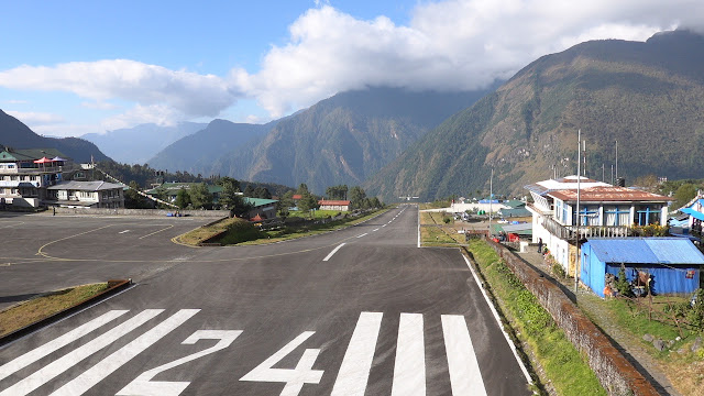
A short,  sloping runway. I'm standing on the wall at the top, watching planes take off. There's no adjusting for wind direction here--you always land uphill, take off downhill.

While we had breakfast, our guides bagged our duffels and loaded them onto the dzokios--yak/cow hybrids that handle lower-elevation packing in the region, where it is too warm for true yaks.

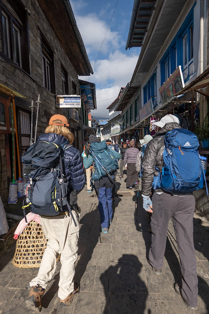
Starting off down Lukla's main street. One thing you notice right away: everything up here happens afoot. There are no vehicles on the "roads" and "streets" of the Khumbu. I hope it stays that way.
Nepal has made a huge, and largely successful, effort at reforestation of these regions, which had been stripped of everything burnable. Now, power comes from a small hydro plant and solar panels, with heat from small stoves that mostly burn dried yak dung.

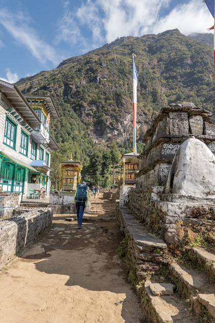
Great excitement at the first several mani walls--always circle them clockwise--and the giant prayer wheels that flanked the route in many places.

Not all prayer wheels were equally well maintained.

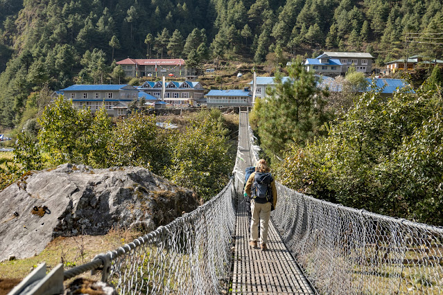
We enjoyed further excitement as we dropped to river level and began to cross bridges, some fixed, more of them swing bridges--and yes, the dzokios, yaks, and donkeys use those same bridges. They always have the right-of-way.


We got even more excited about our first glimpses of snow-and-ice-covered peaks.

Happy to find our first-night lodge. I was surprised how many of the lodges sold (or at least advertised) espresso drinks. I was off coffee for the trip, so never found out if they were any good.

The second day, leaving Monjo for Namche (11,363') meant a big climb. We also entered Sagarmatha National Park almost at once, which caused some thinning of the number of villages and lodges, but not as much as you would expect from a US park model--this park acknowledges and accepts the people who live there, and were there before the park.

Entering the park.


Things did start to feel wilder. The Dudh Koshi is a glacial river (the name means "Milk River"), thus the beautiful color. 

The lower bridge is no longer used, so we climbed to the high bridge. It was... really high.

Really high.

Arriving in Namche.

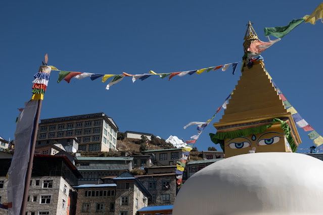
Namche Stupa

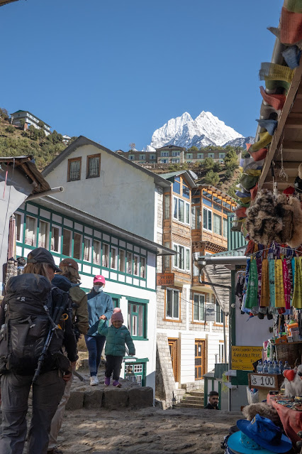
Climbing up the narrow streets and steps to our lodge nearly killed me. I'd been coping with stomach bugs all day, which really impacted my ability to cope with the altitude. I was so happy to see our lodge!
I recovered enough to climb to the Everest viewpoint for sunset, but the clouds moved in, so that all we saw was this lovely photo Lhakpa showed us from that very spot, in 2019.

Two days of hiking, to be followed by a day of rest and altitude adjustment. I'll pick up the story next week!

 ©Rebecca M. Douglass, 2021
 As always, please ask permission to use any photos or text. Link-backs appreciated.

Enjoyed this post? Avoid missing out on future posts by following us.


Friday, August 29, 2014

Trekking the Huayhuash, Part III

When last seen (here), we were settling in to what I believe was our highest camp. The next night, we would be at our lowest camp. The whole way between was downhill, so naturally we had to throw in a gratuitous visit to the highest pass yet! Yes, that's the kind of people we are. But it was worth it. We were up at the crack of dawn, extra early because various members of the party were doing various routes. Most of us headed out in the frosty early morning to climb San Antonio Pass, the highest point on our route (well, the highest was a bit off to the side of the pass where we found more things to climb. It was amazing to realize that we were up at nearly 16,600' and still able to do extra exploring!).
From Punta San Antonio looking back toward camp in the low meadow. Nev. Cuyoc dominates the horizon.
 What we saw from the pass--the setting for the documentary Touching the Void. We had hoped to spend a night up in there, but health limits kept our party on a little easier track. The husband and his nephew, however, opted to descend that side of the pass (with a guide, of course--they don't let you out of their sight!) and hike down the next valley to our camp. The rest of us skidded back down the side we'd come up.
Looking up the Sarapococha valley with Yerupaja straight ahead, Nev. Sarapococho and Siula Grande behind it.

Once we were down to the Huancapatay valley again, the walking was easy and pleasant, with frequent stops to look back and admire the mountain behind us. As usual, the area also featured many stone walls, of varying ages.
Looking back at Nev. Cuyoc as we descended the long Huanacpatay Valley.
After lunch the walk got less pleasant, as we had to make the second big descent. My knees were totally unhappy with me, but as usual, I survived. Down in the bottom of the valley active fields were terraced and marked off by stone walls. Unfortunately, we got to climb some of those walls, as the locals were using the trail for an aquaduct. After the steep climb down to the river, the hike down the valley to Camp 7,in the town, went on far too long; this was our longest day and latest arrival in camp.
We go down there, to Huayllapa just around the corner of the valley.
From our highest camp we went to the lowest, in Huayllapa at about 11,500'. It's weird to think of elevations like that as "low," but it felt it--lots of oxygen, so that I started out in the morning at a brisk pace despite the steep climb back up out of town. It was also weird to camp in the middle of town. We were on the schoolyard, I believe, and shared our space for a time with some kids playing football (soccer).

The climb from Huayllapa to Tapush Punta the next morning was never steep, but it went on a long time, and lower down grew hot (to me) in a hurry. At a stream crossing I finally couldn't stand it any longer, and my husband snapped me wringing out my braids after a head-dunk in the creek.
Climbing 3000' or more up from Huayllapa to Tapush Punta was hot work. Sometimes you just have to go soak your head.
Once we were out of the deep Quebrada (valley) Milo and up into the Q. Huatiaq, the views improved and the air grew more comfortably cool.
There was an easier way up.  Nev. Raju Collota dominates the end of the valley; we cross a pass out of sight to the left.
This might have been anywhere on our treks. We saw lots of sheep, though this was the only flock with such tiny newborns. An adorable fuzz-ball with wobbly legs!
Sheep. There's an ever-renewing supply. I'm guessing this guy was only a day or so old.
By the time we reached the broad, flat Tapush Punta, it was not only very alpine, but the cooling breeze had become the sort of wind that prevents lingering. Good thing we'd had lunch a little lower down (another proof our guides knew what they were doing)!
Approaching Tapush Punta.
Leaving Camp 8 the next morning (and it was farther along than I'd wished, making another long day with a long climb and some uncomfortable descending), we climbed immediately--and fairly painlessly--to our last pass, Llaucha Punta. Our guide led us to a viewpoint a bit above the pass, where we could see the entire heart of the Huayhuash.
All our favorite peaks, from Llaucha Punta, or a little above.
We weren't the first to be there, and maybe not the first to think we could use a little divine help to finish the trip!
Cairns and prayer flags? Llaucha Punta.
As usual, the pass was windy, so we dropped to a nice lunch counter for our snacks. It was a short day, though a substantial descent, so we were in no hurry, with lots of resting and reclining going on.
Snack spot below Llaucha Punta. The boys, reading and resting. They read pretty much the entire Game of Thrones series on this trip. Thank goodness for e-readers!
We stopped for lunch within sight of Camp 9, but why hurry, when the views are like this?
Lago Jahuacocha and Nevadas Rondoy and Jirishanca.  Camp is just visible in the valley at the far left of the photo.
The late afternoon light down in camp was some of the best we'd gotten, and the still creek meandering out of the lake and across the meadow reflected the peaks. We had time for plenty of photography as the sun faded.
Evening reflections.
Our final morning, some of us rose early to add a 4 or 5 mile dayhike to the day's mileage. We went up the valley to the glacial lake below the peaks, climbed the moraine (not too high, but always steep!) and watched the sun rise behind the mountain. All that before breakfast (a true miracle for those who know me; I did eat a couple of food-like bars). The color of the water is due to glacial silt.

The author and our guides at Solteracocha just before sunrise.
After a late breakfast (I think it just about killed the boys to wait) we had a 10-mile hike to the end of the trail. The first several miles were easy, following a pipeline trail, until we had to descend in the usual painful fashion about 2400' to the town of Llamac. We could distract ourselves by watching the vegetation change from alpine to agrarian and semi-desert (saw lots of cacti and then agave on the descent).
Century plant (agave).
Our final night was spent in Llamac, which had the advantage of giving us access to showers of a sort and an early start the next day on the road to Lima (about 9 hours from there). Once again I had to suck it up, hold on tight, and just try not to freak out as we wound back down, then up, then down the narrow and winding roads.

Totally worth it.
Traversing the pipeline trail to Llamac--a last look at the mountains.

###
Next: Machu Picchu and the Sacred Valley.

©Rebecca M. Douglass, 2014